Koppen Climate Classification

Developed by Wladimir Köppen, the Koppen climate system is one of the most commonly used classification system for climate.
According to this system, local vegetation is the best way to express climate and for this reason climate zone boundaries have been chosen with vegetation distribution; keeping the average monthly and annual temperatures and precipitation and the seasonality of precipitation in mind.
This system divides the climates into five main groups and other further sub divisions. In this system climate types are represented by a 2 to 4 letter symbol.
Group A: Tropical/ Megathermal Climate
Tropical climates are described as continuous high temperatures throughout the year near sea level and low elevation areas. They are subdivided as follows:
- Tropical rainforest climate, represented as Af, with average rainfall of at least 60mm throughout the year.
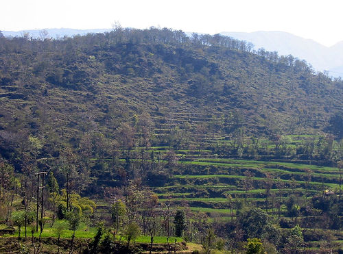
- Tropical monsoon climate, represented as Am, which is most common in southern Asia and West Africa, and monsoon winds changing their direction according to the seasons.
- Tropical wet and dry or savanna climate, Aw, with dry season, and the driest month have rainfall less than 60 mm.
Types Of Forests
- Forests
Piece of land that is thickly covered with trees is the general of definition of a forest. Forest is also known as woods, weald or woodlands. - The Rainforests
Biomes are outlined as the world's leading communities, categorized according to the prevailing vegetation and defined by adjustments of organisms to that specific environment.
Famous Deserts Of The World
- Deserts Of The World
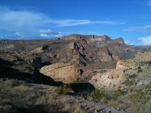
A desert is a type of region or terrain on, Earth's surface which receives very less rainfall compared to other regions. Deserts are extremely dry regions with very little water around.
The World Biomes
- The World Biomes
The world seems no less a magical place than the world of fairy tales. If you don't believe me then think about the seasons, and the different climates that different regions in the world boast of at the same time.
Group B: Dry: Arid And Semiarid Climate
This climate is described as rainfall less than the required evapotranspiration limit. Precipitation threshold can be calculated by this method:
Average annual temperature (°C) x 20 + 280
- If the results are 70% or more, there is sun half of the year; from April to September in the Northern Hemisphere and from October to March in the Southern.
- If the annual precipitation is less than half the threshold for Group B, it is classified as desert climate, represented as BW; if it is less than the threshold but more than half the threshold, it is classified as steppe climate, represented as BS. The area does not include in group B climate if the climate is more than the threshold, Added ‘h’ signifies low latitude climate with average annual temperature above 18 °C and ‘k’ middle latitude climate with average annual temperature below 18 °C Examples of such regions are Ellinikon, Athens, Greece, represented as BSh; Yuma, Arizona, United States, represented as BWh; Mexicali, Mexico, represented as BWh; Almería, Spain, represented as BWh; Cobar, New South Wales, Australia, represented as BSh; etc.
Group C: Temperate/Mesothermal Climate
Group C climates have an average temperature above 10 °C in hot months and between −3 ° C and -18 °C in coldest month. Here second letter indicates the pattern of rainfall and third the degree of summer heat. ‘w’ indicates dry winters, ‘s’ indicates dry summers and ‘f’ indicates a lot of rainfall precipitation in all seasons.
‘A’ indicates warmest month with average temperature rising above 22 °C, ‘b’ indicates warmest month with average temperature below 22 °C, and ‘c’ indicates mean temperatures above 10 °C. Group C climates are subdivided into:
- Dry-summer subtropical or Mediterranean climate, represented as Csa, Csb, usually occurring on the western part of continents between the latitudes of 30° and 45°.
- Humid subtropical climatesare represented as Cfa, Cw, occurring in the interiors of continents, or on their east coasts, in the high latitude of 20 and 30.
- Temperate climate with dry winters, represented as Cwb, is a type of climate common to highlands of Mexico, Peru, Bolivia, Madagascar, Zambia, Zimbabwe, South Africa and even in Argentine province of Cordoba.
- Maritime Subarctic climates are Subpolar Oceanic climates represented as Cfc.
Natural Regions Of The Earth
- Natural Regions
The surface of the Earth is divided into twelve natural regions. These regions have been categorized on the basis of surface features, climate and vegetation.
Group D: Continental/Microthermal Climate
These climates have an average temperature above 10 °C in hot months, and cold months having average temperatures below −3 °C, in the interiors of continents, or on their east coasts, north of 40° North latitude.
The second and third letters are used same as in Group C climates, ‘d’ as third letter indicates three or lesser months with mean temperatures above 10 °C and a coldest month temperature below −38 °C. Group D climates are subdivided into:
- Hot Summer Continental climates, represented as Dfa, Dwa, Dsa,
- Warm Summer Continental or Hemiboreal climates are represented as Dfb, Dwb, Dsb
- Continental Subarctic or Boreal (taiga) climates are represented as Dfc, Dwc, Dsc
- Continental Subarctic climates with extremely severe winters as Dfd, Dwd, occur only in eastern Siberia

Group E: Polar Climates
This group climate is indicated by average temperatures below 10 °C throughout the year. This group is further divided into:
- Tundra climate, represented as ET, with warmest month has average temperature between 0 °C and 10 °C.
- Ice Cap climate, represented as EF, are average temperatures below 0 °C throughout the year.
The Frozen Antarctica
- Antarctica Facts
The word Antarctica is taken from the Greek word 'Antarktik' which means opposite to the North.


